Central Alberta Backroad Mapbook
- Publisher
- Mussio Ventures Ltd.
- Initial publish date
- May 2019
- Category
- Atlases
-
Book
- ISBN
- 9781926806907
- Publish Date
- May 2019
- List Price
- $29.95
Add it to your shelf
Where to buy it
Description
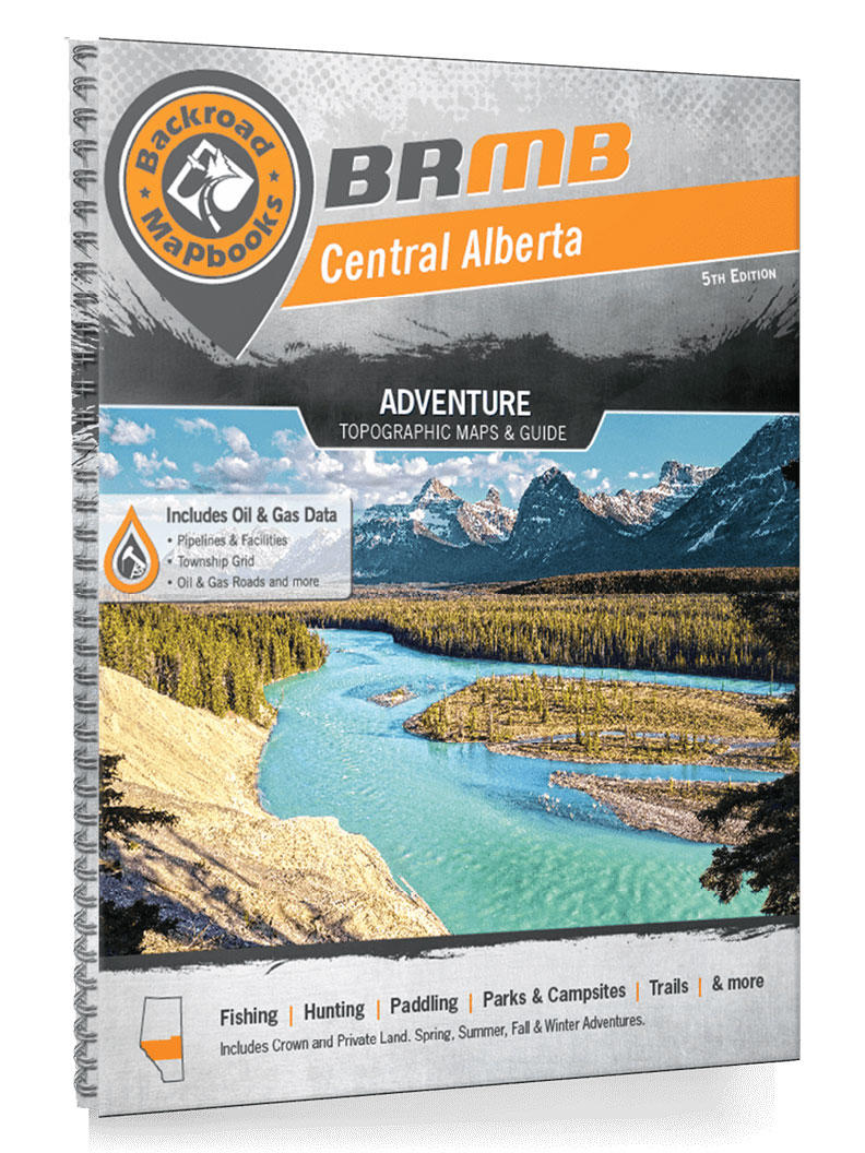
This 208 page backroad mapbook includes 69 maps at 1:250,000. Map features include highways, logging roads, land & water features, parks, adventure points of interest, campgrounds, hiking trails, motorized trails, paddling routes, hunting & fishing areas, winter recreation and more. Areas covered include Bonnyville, Camrose, Caroline, Cold Lake, Drayton Valley, Edmonton, Edson, Grande Cache, Hinton, Jasper, Lac La Biche, Lloydminster, Nordegg, Red Deer, Rocky Mountain House, Saskatchewan River Crossing, Sundre, Whitecourt and more!
Covering the central region of the province of Alberta, including the cities of Red Deer and Edmonton, this book is your ultimate guide to camping, hiking, fishing, ATVing, hunting, snowmobiling, paddling and industry resource sites in this spectacular region. From the area around Lac La Biche in the northeastern reaches of this book, where some of Alberta’s best lake fishing can be found, to the stunning Rocky Mountain Parks in the western reaches and the sprawling prairie wilderness in between, Central Alberta is full of outdoor adventure opportunities.
We have spent countless hours updating our maps and expanding our written content to allow you to get out and explore this magical part of Canada with the utmost confidence. Our maps now show Crown and private land, labelled fish species for fishing lakes, Municipal District Areas and Grazing Reserves, Oil & Gas facilities, along with the most complete Resource, Industry and Logging road coverage available for Central Alberta. We have also added stocking charts for the region’s stocked fish species as well as trail charts for its major hiking areas. We can confidently say that there is no better resource available for making the most out of Central Alberta’s great outdoors!
The latest version of the mapbook comes in the convenient 21.5 x 28 cm (8.5 x 11 inch) mapbook format with a heavy-duty spiral-bound cover. The 208 page book includes 69 maps at 1:250,000 scale, along with 10 Outdoor Adventure sections, a Service Provider Directory, Map and Adventure Index, Trip Planning tools and more. With over 180,000 kilometres of roads to view including the most complete logging and industrial road coverage available, the books are ideal for navigating on road trips and planning from home.
21.5 x 28 cm (8.5 x 11 in)
About the authors
Russell Mussio was born in Trail, BC where he spent his childhood years playing sports and exploring the Great Outdoors. At a time when parents simply called their kids back for dinner, Russell and friends could be found fishing local streams, hiking and biking nearby trails and even chasing grouse and deer around the hills.
His family, in particular his father Sergio and brother Wesley, were instrumental in introducing him to the trials and tribulations of outdoor adventure. From camping throughout the parks and recreation sites of BC to hunting and fishing in the Kootenays it seemed every vacation had an outdoor theme. From these early beginnings, Russell grew a strong appreciation of the outdoors.
Russell attended the University of British Columbia where he explored a few different career options before settling in on a degree in Leisure and Sport Administration. Before graduating he took a year off to travel the world. From this experience Russell developed a passion for outdoor travel, which he was able to develop through his final year at university. Backed by a sponsor professor, he was able to explore two different outdoor recreation business concepts. The guidebook business that he and his brother stumbled across when exploring the wilderness around Vancouver seemed to be the most logical concept. That is where the idea for the Backroad Mapbook series was born.
After graduation Russell, along with Wesley, went about self-publishing their first guidebook called the Backroad and Outdoor Recreation Mapbook: Southwestern BC for a tradeshow in January 1994. By March 1994, the first printing of the book was sold out. But rather than simply reprinting it, they listened to the feedback of the readers and retailers and improved it. This constant desire to create the best book in the most convenient and economical package possible has helped the brothers and their publishing company, Mussio Ventures Ltd., produce over 40 National Bestseller titles. Today, Mussio Ventures, through their signature series Backroad Mapbooks, is Canada's leading outdoor recreation publisher.
Russell now lives in Lake Country, BC with his wife and two children. In addition to helping run the publishing company and family commitments, he is involved with the local park department and outdoors club. Although he spends as much time as he can exploring the backroads of Canada, he always seems to return to the pen to write. He has been published in several different magazines, newspapers and websites across the country including regular contributions to Adventure West magazine, and several articles published in The Province newspaper out of Vancouver, BC.
The seed for Backroad Mapbooks was planted in 1993. Brothers Wesley and Russell Mussio were out exploring the maze of logging roads around Harrison Lake in southern BC on a cold, wet day. They had several books and a few maps to try to find their way, yet all of their sources showed no more than the area’s main road system. Even worse, most of the maps were outdated. The Trail, BC-born brothers quickly found themselves lost.
Frustrated, Wesley asked Russell, “Why doesn’t someone make one guide that shows all the roads?” With that, a lightbulb went off, and the pair got down to work. By January of 1994, the Mussio brothers had published their first map book, and it quickly sold out. Rather than simply reprinting it, the entrepreneurial duo decided to take stock of customer feedback and make a number of improvements to the book.
The constant improvements to the product carried on for the next two decades, helping to establish Backroad Mapbooks as the top-selling outdoor recreation guidebook series in Canada. Today, Backroad Mapbooks has expanded to chart all ten provinces and the Yukon Territory, with industry-leading GPS maps, a smartphone app, waterproof maps and more. From its humble beginnings in a tiny Vancouver apartment with maps strewn all over the walls, to one of the most sought-after outdoor products in the country, the Backroad Mapbooks series has come a long way.
In true pioneer spirit, Backroad Mapbooks will only continue to break new ground and seek out the ever-expanding horizon.
Other titles by

Cariboo Region BC Fishing

Vancouver Island North Adventure Map

Northern BC Backroad Mapbook

Cariboo Chilcotin Coast BC Backroad Mapbook

Canadian Rockies Backroad Mapbook
3rd Edition

Northwestern Ontario Backroad Mapbook

Okanagan Valley & Shuswap Adventure Map

Kootenay Rockies BC Backroad Mapbook

Vancouver Island BC Backroad Mapbook

Vancouver Coast & Mountains BC Backroad Mapbook
Other titles by
Cariboo Region BC Fishing
Vancouver Island North Adventure Map
Northern BC Backroad Mapbook
Cariboo Chilcotin Coast BC Backroad Mapbook
Canadian Rockies Backroad Mapbook
3rd Edition
Northwestern Ontario Backroad Mapbook
Okanagan Valley & Shuswap Adventure Map
Kootenay Rockies BC Backroad Mapbook
Vancouver Island BC Backroad Mapbook