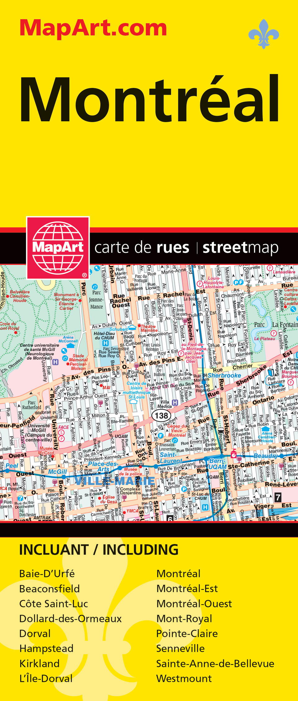
Description
Folded maps have been the trusted standard for years, offering unbeatable accuracy and reliability at a great price. Detailed indices make for quick and easy location of destinations. The folded map of Montréal contains detailed city mapping of Montréal (Baie-D’Urfé, Beaconsfield, Côte Saint-Luc, Dollard-des-Ormeaux, Dorval, Hampstead, Kirkland, L’Île-Dorval, Montréal, Montréal-Est, Montréal-Ouest, Mont-Royal, Pointe-Claire, Senneville, Sainte-Anne-de-Bellevue, Westmount) at a scale of 1:27,800, a downtown Montréal map at 1:15,000, a Métro transportation map, city map legend and street index. Bilingual.
The city map features include divided highways, major roads, secondary roads, main thoroughfares, minor streets, lanes / private streets, pedestrian streets, bus only streets, interchange numbers, one way streets, street address numbers, Trans-Canada Highway, railways, VIA Rail stations, Métro, EXO train stations, bus stations, ferries, recreation trails, parks / conservation areas, golf courses, commercial areas, cemeteries, institutional areas, industrial areas, special attraction areas, Indian Reserves, National Defence, tourist information centres, police stations, fire halls, libraries, points of interest, casinos, national parks / historic sites, arenas, community / recreation centres, pools, baseball, soccer, tennis, skiing, campgrounds and schools. Proudly made in Canada!
Folded: 10.2 x 23.5 cm (4 x 9.25 inches) Unfolded: 68.6 x 99.7 cm (27 x 39.25 inches)
Provinces/Territories: Quebec


