Quebec Province Wall Map
- Publisher
- MapArt Publishing Corporation
- Initial publish date
- Dec 2020
- Category
- Atlases
-
Sheet map, rolled
- ISBN
- 9781553685944
- Publish Date
- Dec 2020
- List Price
- $49.95
Add it to your shelf
Where to buy it
Description
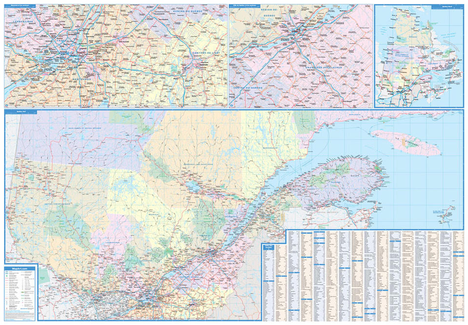
Laminated wall maps are ideal for the office, home or the classroom.
Colourful laminated wall map of the province of Québec includes provincial maps of southern Québec at 1:1,000,000, northern Québec map at 1:4,545,454, regional maps of Montréal and area at 1:500,000 and Québec City and area at 1:500,000, a community name index and map legend.
The detailed map features include undivided roads, Trans-Canada Highway, paved and loose surface major roads, divided roads, paved and loose surface secondary roads, paved and loose surface other roads, unimproved roads, railways, distances between points (km), ferries, customs offices, major airports, hospitals, tourist information centres, international boundaries, provincial boundaries, populations, provincial capitals, national parks or historic sites, provincial parks, wilderness reserves, campgrounds, downhill skiing, picnic sites or service centres and tourist regions.
Proudly made in Canada!
Rolled: 4.76 x 105.4 cm (1.875 x 41.5 inches) Unrolled: 150 x 104 cm (59 x 41 inches)
Provinces/Territories: Quebec


